


Center for Coastal & Ocean Mapping / NOAA Joint Hydrographic Center
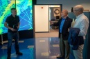
Urban Coast Institute Honors Mayer
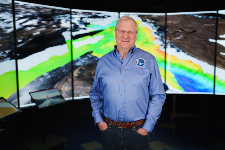
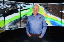
Larry Mayer, professor and director of UNH’s Center for Coastal and Ocean Mapping, received the National Champion of the Ocean Award from the Urban Coast Institute (UCI) of Monmouth University in New Jersey. The award was established in 2005 to honor individuals who have undertaken actions and... Read More


-
 08/11/25
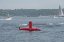
UNH Researchers Help Find WWII Shipwrecks in Solomon Islands
Researchers from UNH's Center for Coastal and Ocean Mapping helped find more than a dozen World War II shipwrecks in the Solomon Islands. -
 04/22/25
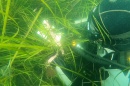
Could microplastics impact the ocean's carbon storage?
UNH researchers have received an NSF grant to study the impacts of microplastics on the ocean's microbial food web. -
 04/07/25
Mapping the Deep
In December 2023, thanks to UNH, the United States grew by one million square kilometers. The U.S. gained that seabed territory beyond 200 nautical... -
 04/02/25
CCOM’s Brian Calder Elected to Hydrographer Hall of Fame
CCOM's Brian Calder has been elected to the Hydrographer Hall of Fame for his remarkable contributions to seafloor mapping technologies.
Recent Stories
-
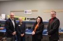 03/20/25 - Olson Center Welcomes Klein Sonar Innovation LabKlein Marine Systems, a global leader in sonar technology based in Salem, New Hampshire, recently dedicated the Klein Sonar Innovation Lab at UNH’s John Olson Advanced... Read More
 -
 11/27/24 - Biden Appoints Larry Mayer to Chair U.S. Arctic Research CommissionLarry Mayer, director of UNH's Center for Coastal and Ocean Mapping, has been appointed chairperson of the U.S. Arctic Research Commission. Read More
 -
 10/29/24 - External Funding for UNH Research Leaps to $252 MillionUNH researchers brought in $252 million in competitive external funding in fiscal year 2024, supporting projects that aim to solve problems and improve lives in New Hampshire and... Read More
 -
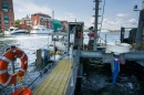
 08/26/24 - UNH Ocean Mappers Make History Navigating North Greenland ArcticScientists from the University of New Hampshire have made history as part of a team aboard the Swedish icebreaker ODEN, which is the first vessel to navigate the remote and icy... Read More
 -
 08/08/24 - 5 Ways Wildcats Are Staying Cool This SummerSummer of ’24 has already broken heat records here in New England, but some in our UNH community are staying cool. Here are five ways our ’Cats are beating the dog days of summer... Read More
 -
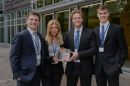 05/09/24 - Wave of Innovation: Drift-RMT Takes Home Top Holloway PrizeA team specializing in engineering and business earned the $15,000 grand prize at the 36th Paul J. Holloway Prize Innovation to Market Competition. Drift-RMT emerged victorious... Read More
 -
 09/21/23 - NOAA Administrator Announces New Ocean Mapping Center of Excellence at UNHNOAA Administrator Rick Spinrad announced the creation of the Center of Excellence for Operational Ocean and Great Lakes Mapping at UNH during a visit to campus. Read More
 -
 07/18/23 - UNH and Exail Open Marine Autonomy Innovation HubUNH and French technology company Exail celebrated the opening of the new Marine Autonomy Innovation Hub at UNH. Read More
 -
 04/28/23 - Using Passive Acoustic Monitoring and Genetics to Determine Habitat Connectivity in the Gulf of MaineNew research at the UNH College of Life Sciences and Agriculture and the Center for Acoustics Research & Education uses passive acoustic monitoring and metabarcoding seawater... Read More
 -
 03/01/23 - UNH Researchers Help Discover 1894 Shipwreck in Lake HuronResearchers from the University of New Hampshire were part of a world-renowned team that found an intact shipwreck from the 19th century hundreds of feet below the surface of Lake... Read More