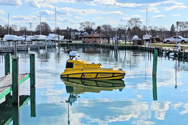
UNH's autonomous surface vehicle BEN (Bathymetric Explorer and Navigator) contributed state-of-the-art underwater mapping technology that was critical in the discovery of Ironton, which sank in Lake Huron in 1894.
Researchers from the University of New Hampshire were part of a world-renowned team that found an intact shipwreck from the 19th century hundreds of feet below the surface of Lake Huron.
Looking like it was frozen in time, the 191-foot, three masted sailing ship Ironton sank in the waters of Lake Huron in 1894. UNH’s autonomous surface vehicle (ASV) named BEN (Bathymetric Explorer and Navigator) provided state-of-the-art underwater mapping technology that was instrumental in the discovery, which occurred in 2019 (officials have withheld announcement of the find in order for visual documentation to be completed before divers could disturb the site.)
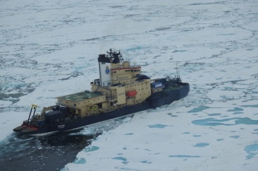
During this NOAA-led expedition, UNH worked with several search teams made up of scientists, historians and underwater archaeologists, including those from the state of Michigan and the Ocean Exploration Trust, founded by famed explorer Robert Ballard, who located the wreckage of the Titanic.
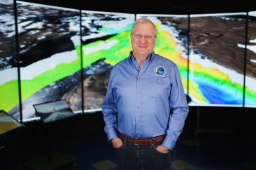
“This was an exciting expedition for our researchers and students to be a part of and is exactly the kind of ocean mapping BEN was built to do,” said Val Schmidt, principal research project manager and UNH team lead. “The autonomous surface vehicle is designed to explore the seafloor or lakebeds, especially in areas that may be too deep for divers or too shallow for larger ships.”

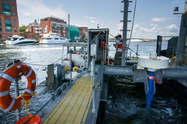
BEN is operated by UNH’s Center for Coastal and Ocean Mapping (CCOM) and contains state-of-the-art seafloor mapping systems. The 12-foot, diesel-powered, self-driving boat is equipped with a high-resolution multibeam sonar that allows it to make 3D topographic and acoustic backscatter maps of an ocean floor, or for this mission, a lakebed. BEN worked in tandem with NOAA's Great Lakes Environmental Research Lab's RV Storm, which has similar equipment, to map the area where Ironton was thought to be located. After days of mapping, persistence and determination the team produced an image of a shipwreck that matched the description of Ironton.
“The sonar images were spectacular,” said Schmidt. “The vessel was preserved in the Great Lake resting right side up, masts still standing as though it just sailed down to the bottom of the lake.”
BEN’s seafloor mapping systems include a Kongsberg multibeam echo-sounder and Applanix POS/MV navigation system, similar to the equipment on the RV Storm. CCOM developed mission planning and “back-seat-driver" control software designed specifically for piloting BEN. BEN was manufactured by ASV Global, in a design collaboration with CCOM.
Team members involved in the discovery included Schmidt, KG Fairbarn, research project engineer, Andy McLeod, research project manager, Roland Arsenault, information technologist, graduate student Lynette Davis, Ph.D. student Coral Moreno, Clint Marcus ’21 and Erin Heffron ‘22.
More information about the expedition is available on NOAA’s Thunder Bay National Marine Sanctuary website.
-
Written By:
Robbin Ray ’82 | UNH Marketing | robbin.ray@unh.edu | 603-862-4864