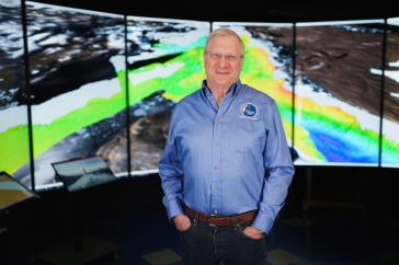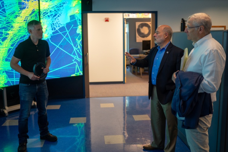
NOAA Administrator Rick Spinrad (center) visited the data visualization research laboratory at UNH's Center for Coastal and Ocean Mapping, where lab director Tom Butkiewicz (left) and CCOM director Larry Mayer introduced him to the lab's cutting-edge capacities. Photo by Scott Ripley.
NOAA and UNH are expanding a 24-year mapping partnership through the creation of a new Center of Excellence for Operational Ocean and Great Lakes Mapping at UNH.
“NOAA and UNH have a long history of collaborating to advance the latest technologies and tools to map our ocean, coasts and Great Lakes — a cornerstone of the blue economy.”
“NOAA and UNH have a long history of collaborating to advance the latest technologies and tools to map our ocean, coasts and Great Lakes — a cornerstone of the blue economy,” says NOAA Administrator Rick Spinrad, who visited campus recently (Sept. 19, 2023) to announce the Center of Excellence. “Our continued partnership on the Center of Excellence will help build a workforce ready to tackle the mapping challenges of the future, and further our understanding of our changing ocean and coasts.”
Spinrad joined Larry Mayer, director of UNH’s Center for Coastal and Ocean Mapping (CCOM) and co-director of the UNH/NOAA Joint Hydrographic Center (JHC), and Marian McCord, senior vice provost for research, economic engagement and outreach, on a tour of UNH’s extensive ocean mapping facilities. At Chase Ocean Engineering Laboratory, Spinrad dropped in on a graduate-level class, met NOAA staff who work alongside UNH researchers, got hands-on experience with CCOM’s data visualization capacities and visited the test tank and other facilities in the high bay area.
He also toured UNH’s John Olson Advanced Manufacturing Center, where he formally announced the Center of Excellence at a press conference, noting UNH’s “extraordinary legacy in mapping.” The Center of Excellence is funded through NOAA’s budget, and will complement existing research, technical expertise and advanced educational programs at CCOM/JHC.

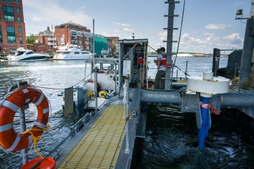
A portion of the funding — $20 million over the next three years — will be used by UNH to construct a new, state-of-the-art ocean mapping facility that will include office and instructional space, as well as a large, high-ceiling area with overhead cranes known as a high bay for storing, outfitting and staging bulky equipment and small vessels.
“The Center of Excellence will build upon our decades-long partnership with NOAA, as well as grow the critical research field of ocean and Great Lakes mapping, where we can engage with industry leaders to develop and train the next generation of mappers,” says Marian McCord, senior vice provost for research, economic engagement and outreach at UNH.
“The University of New Hampshire’s world-class Center for Coastal and Ocean Mapping and Joint Hydrographic Center has led the way for more than two decades in ocean mapping, helping ensure safe marine transportation and understanding coastal hazards. This leadership is affirmed by NOAA locating a new Center of Excellence for Operational Ocean and Great Lakes Mapping on UNH’s campus. With this NOAA grant I helped secure, New Hampshire’s ongoing research and training programs will remain ahead of the curve in this leading field,” says Senator Jeanne Shaheen, chair of the Senate Appropriations subcommittee that funds NOAA.
The Center of Excellence will focus on the following priorities:
- Delivering practical hydrographic training and fostering workforce development for ocean mapping operations;
- Providing technical expertise and systems support for NOAA’s mapping operations on an increasingly diverse set of platforms, including new ships and uncrewed survey vessels;
- Leveraging public-private partnerships; and
- Partnering with academia and industry to transition ocean mapping research to operations.
Ocean mapping data is the basis for researching, exploring and characterizing our nation’s ocean, coasts and Great Lakes in order to support maritime commerce, transportation and emergency response activities. Ocean and Great Lakes mapping provides foundational data for a wide range of key NOAA priorities, including modeling and forecasting water levels, currents, storm surge and tsunami inundation; fisheries habitat identification; marine protected area site selection and management; and environmentally sound offshore energy development. Learn more about NOAA’s mapping responsibilities through the Office of Coast Survey.
-
Written By:
Beth Potier | UNH Marketing | beth.potier@unh.edu | 2-1566