In a new study, University of New Hampshire researchers have concluded that when assessing forest imagery collected by unmanned aerial systems, an alternative method of delineating individual forest tree crowns within those images is more accurate than the most commonly used method, the canopy height model.
Monitoring Forest Edge Changes Using Drones
Unpiloted aerial systems help identify changes to forest edges
Friday, February 24, 2023

A digital surface model (elevation) transitioning to an orthomosaic of the forest canopy; both generated from unpiloted aerial system imagery collected as part of this study.
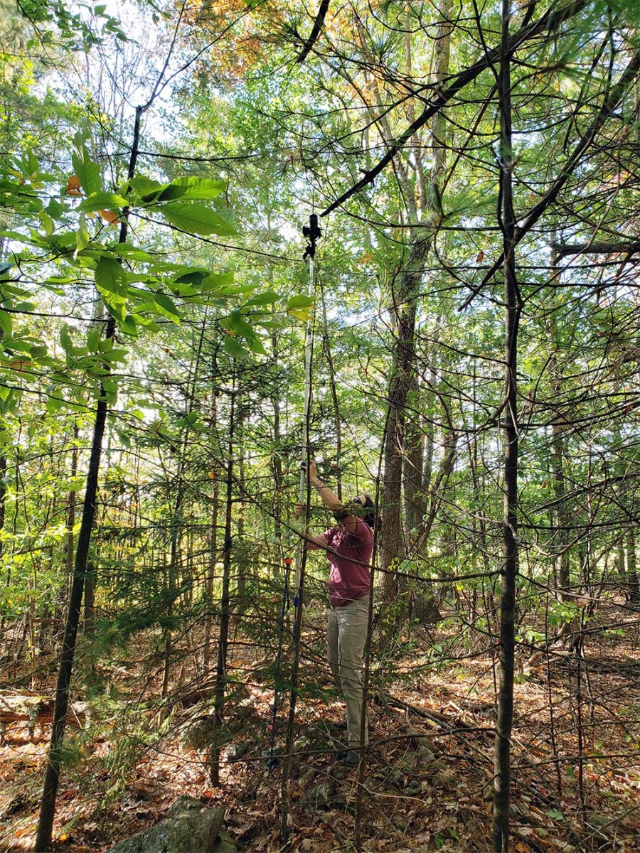
Above: Co-author Heather Grybas conducting the ground data collection (digital canopy photography) using a camera mounted to a telescoping pole and lifted 4 meters in the air, pointing up at the underside of the canopy.
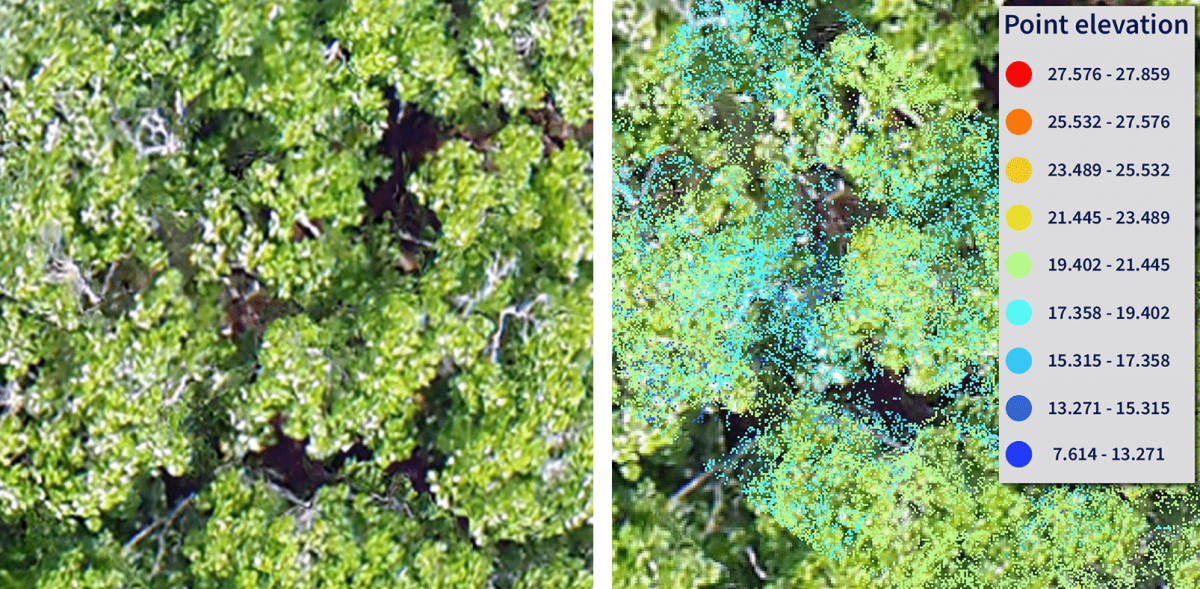
Below: An example of one of the digital photographs captured by this setup. The percentage of visible sky (i.e., foliage cover) is measured in each image.

At nearly 80 percent forest coverage, New Hampshire ranks as the second-most forested state (behind only Maine) in the U.S. However, as urban growth has expanded in the Granite State over the past several decades, the state’s diverse and ecologically important forestlands have become fragmented, creating not only new forest edges—portions of the forest abutting developed or open space—but questions about the ecosystem changes around these gateways to New Hampshire’s woodlands. Scientists with the New Hampshire Agricultural Experiment Station (NHAES) are answering these questions by using emerging and increasingly cost-effective unpiloted aerial system (UAS) technologies to study characteristics around forest edges.
NHAES researcher Russ Congalton, a professor in the natural resources and the environment department, and Heather Grybas ’15G, a graduate student researcher in Congalton’s Basic and Applied Spatial Analysis Lab (BASAL), recently summarized their findings on using UAS for measuring edge influences in INSPIRED Forestry (Winter 2023). In forestry, edge influence or edge effect refers to the ecological changes resulting from the fragmentation and creation of new edges in fragmented forest.
“When a new forest edge is created, significant changes occur,” describes Congalton. “More light enters that part of the forest, temperature and wind become more variable and the forest structure changes as invasive species are often introduced. Ultimately, the plants and animals that once existed in a large, forested patch may not be able to live in the smaller patches with new edges.”
Fig. 1: Progression that occurs when an edge is created where forest area is removed. Initially, there is more light and wind and a greater variation in temperature. These added variables can result in tree mortality, under-story release and changes in species composition, including the addition of invasive plants.
The use of UAS imagery allows foresters, landowners and researchers to complement observations collected from the ground by accurately identifying the canopy cover of trees at the forest edges. Conducting their study of forest edges at Blue Hills Foundation lands in southern New Hampshire, the research team collected 1,299 images taken at 100 meters above tree canopy. By creating three-dimensional point-clouds and mosaics from the imagery, along with ground observations, they could identify that forest coverage decreased within 150 feet of the new edge, followed by an increase in forest cover from 150–330 feet from the new edge.
“If we want to structure our forest management to avoid or reduce any negative impacts of edge effects, we need to understand what the effects are,” said Grybas. “Edge effects, however, can be highly variable for many reasons, and it takes a lot of time on the ground to understand not only what the effects are but their magnitude, extent and controlling factors.”
“Our study demonstrated that we could use UAS to detect and measure those effects which can save a lot of time–time that can be used to further our understanding,” she added.
Ultimately, the use of UAS allowed the researchers to sample more sections of the forest and determine greater variability among canopy cover.
According to Congalton, remotely sensed imagery has played a role in forest management for many years. However, with the recent advancements in UAS, the ability to capture imagery has become significantly easier, allowing scientists and land managers alike to detect, measure and study everything from species composition and tree health, height and crown size to invasive species and riparian versus upland habitat.
“Clearly, the more information we can generate, the more effectively we can manage our forests for a sustainable future,” said Congalton.
This material is based on work supported by the NH Agricultural Experiment Station through joint funding from the USDA National Institute of Food and Agriculture (under Hatch award number 1026105) and the state of New Hampshire. This work is co-authored by Heather Grybas and Russell Congalton.
You can read Evaluating edge influence effects on forest canopy cover using imagery from unpiloted aerial systems (UAS) in the INSPIRED Forestry Research Report from the New Hampshire Agricultural Experiment Station.
-
Written By:
Nicholas Gosling '06 | COLSA/NH Agricultural Experiment Station | nicholas.gosling@unh.edu