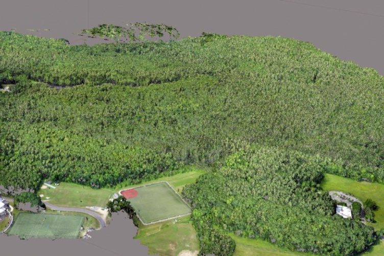
UNH researchers map UNH's College Woods using an Unmanned Aerial System. Credit: Russ Congalton/UNH
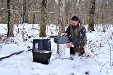
The collection of imagery from Unmanned Aerial Systems offer scientists new methods and strategies to assess ecological changes of forests and land cover. Scientists with the New Hampshire Agricultural Experiment Station at the University of New Hampshire recently analyzed effectiveness of Unmanned Aerial Systems to collect meaningful forestry data, which is key for making informed environmental policy decisions.
“Remote sensing is learning something about an object without coming in contact with it – so trying to learn from a distance. There are many benefits to this because we can collect information at different levels of detail at various spatial scales. We can use different portions of the electromagnetic spectrum, and we can do it over different timeframes. Some projects require knowing something every hour. Some things we want to know about once a year,” said experiment station researcher Russell Congalton, professor of remote sensing and geographic information systems. Congalton conducted this research with Benjamin Fraser, a doctoral student in his research lab.
“To form comprehensive understanding of natural environments and their patterns of change, scientists and resource managers must use modern tools to assimilate mass amounts of heterogeneous data, at multiple scales. Then, they must translate that data into useful decision-making information. Unmanned Aerial Systems offers new opportunities to provide such information,” they said.
According to Congalton and Fraser, Unmanned Aerial Systems offer users the ability to capture imagery at unprecedented spatial resolutions due to their flexible designs, low costs, automated workflows, and minimal technical knowledge requirements. Their rapid extension into new disciplines such as natural resources and the environment brings with it a necessity to question and understand data quality of the respective products.
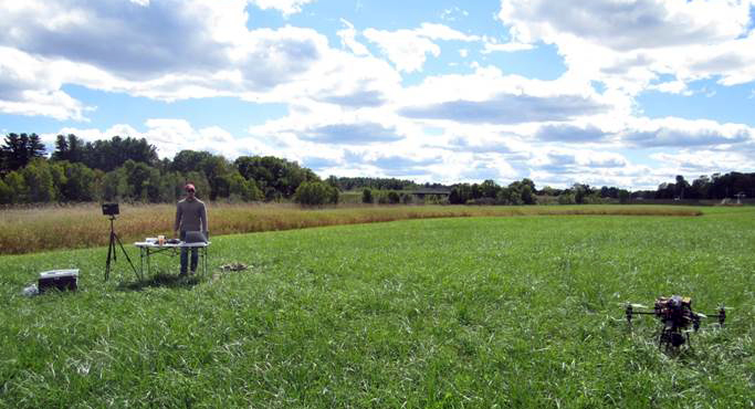
Experiment station scientists conducted research using an eBee Plus, fixed-wing drone on three woodland properties owned and managed by the University of New Hampshire – the Kingman Research Farm, Moore Field, and West Foss Farm. These properties total approximately 154.6ha of forested land and 235.2ha of total area.

Researchers were interested in evaluating the impacts of flying height on Structure from Motion (SfM) processing success, discrepancies in software output results, and the effects of processing parameter quality. Structure from Motion is a photogrammetric imaging technique for estimating three-dimensional structures from two-dimensional image sequences.
After experimenting with flying the eBee Plus at heights of 50m, 100m, and 120m above the forest canopy, scientists concluded it is impractical to process imagery captured at lower than 100m. Overall the 100m flying height provided the highest quality results.
Regarding software output results, Congalton and Fraser compared Agisoft PhotoScan with Pix4D Mapper Pro, two leading SfM software packages. They found greater image calibration success and model resolution with Agisoft. Finally, a comparison of high and medium quality processing workflows in Agisoft showed only marginal advantages in choosing the added data quality over the added time.
“As Unmanned Aerial Systems continue to expand their sphere of influence and develop technologically, data quality evaluation methods and best use practices based on aerial photogrammetry principles must remain apparent” Congalton said.
This research is presented in the journal Remote Sensing in the article Issues in Unmanneed Aerial Systems (UAS) Data Collection of Complex Forest Environments (DOI: http://www.mdpi.com/2072-4292/10/6/908). Congalton also recently presented this research at the 2018 NH Farm and Forest Exposition in the educational session Using Unmanned Aerial Systems to Map Forests: Some Lessons Learned.
This material is based upon work supported by the NH Agricultural Experiment Station, through joint funding of the National Institute of Food and Agriculture, U.S. Department of Agriculture, under award number 1002519, and the state of New Hampshire.
Founded in 1887, the NH Agricultural Experiment Station at the UNH College of Life Sciences and Agriculture is UNH’s original research center and an elemental component of New Hampshire's land-grant university heritage and mission. We steward federal and state funding, including support from the USDA National Institute of Food and Agriculture, to provide unbiased and objective research concerning diverse aspects of sustainable agriculture and foods, aquaculture, forest management, and related wildlife, natural resources and rural community topics. We maintain the Woodman and Kingman agronomy and horticultural research farms, the Macfarlane Research Greenhouses, the Fairchild Dairy Teaching and Research Center, and the Organic Dairy Research Farm. Additional properties also provide forage, forests and woodlands in direct support to research, teaching, and outreach.
-
Written By:
Lori Tyler Gula, PhD | NH Agricultural Experiment Station | lori.gula@unh.edu | 603-862-1452