UNH's Center for Coastal and Ocean Mapping is coordinating a team of alumni shooting for the Shell Ocean Discovery XPRIZE.
Each year, ocean mappers from across the globe spend a year at UNH learning the latest ocean mapping techniques from the experts at UNH’s Center for Coastal and Ocean Mapping (CCOM), bringing their training back to their native countries.

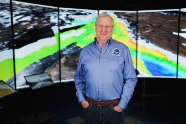
Now, nine of those well-trained hydrographers, led by CCOM’s Rochelle Wigley (herself an alumna of the training program), are putting their UNH education to work for a run at the Shell Ocean Discovery XPRIZE that aims to spur solutions for mapping the entire seafloor by 2030.
“It’s really exciting,” says Wigley, who directs UNH’s Nippon Foundation/GEBCO (General Bathymetric Chart of the Oceans) Ocean Bathymetry training program. “But most of the time I’m completely terrified because I’m overwhelmed at what we are trying to do.”
The GEBCO-NF Alumni team is one of 19 semifinalist teams in the running for the $7 million Shell Ocean Discovery XPRIZE, a global competition that challenges teams to advance technologies for rapid, unmanned and high-resolution ocean exploration and discovery. The success of the competition will further the goal of mapping the entire ocean floor.
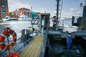
Boosted by a $3 million grant from the Nippon Foundation, the GEBCO-NF Alumni team is designing a new unmanned surface vehicle (USV) called SEA-KIT to pair with existing autonomous underwater vehicle (AUV) technology to autonomously map the seafloor for longer time periods and over wider ranges and environments.
“What’s really novel about our idea is that we’re using largely off-the-shelf existing technology in conjunction with our new surface vessel,” says Wigley, adding that the market for unmanned technology is growing exponentially. “Nearly everyone who’s seen our design is excited by the innovative concept.”
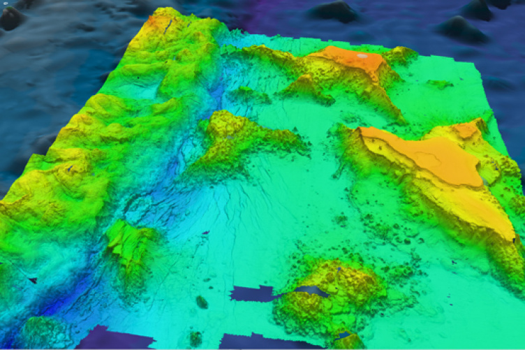
Controlled from shore, the unmanned 11-meter SEA-KIT will travel to the test site offshore, where it will then deploy and retrieve the 1.2 ton Kongsberg Maritime HUGIN AUV, which is owned by Ocean Floor Geophysics. That device “swims” about 40 meters above the seafloor and uses interferometric side scan sonar to produce an image of the seafloor that Wigley describes as a “photograph draped over the surface.”

“It’s visually easy to understand,” she says, and that’s important. “Part of what XPRIZE wants is data that excites, and I think that excites more. The general public has a better understanding of photo images.”
Go-time for the team comes this fall, when the Shell Ocean Discovery XPRIZE administrators will assign them one week to conduct sea trials of their technology. They’ll then have 16 hours at sea to gather data and an additional two days to prepare their presentation, utilizing tools developed with Teledyne CARIS software
The Shell Ocean Discovery XPRIZE challenge has served as a reunion and alumni association of sorts for the team members, who hail from eight countries (Israel, Japan, Malaysia, Poland, Russia, South Africa, USA, and the Philippines) and all hold positions in their own nations’ maritime industries. Since its inception, UNH’s GEBCO program has graduated 78 scholars total, the vast majority of whom are working in the marine industry.
“This is a real indication of how strong the education is here at UNH,” says Wigley. “Without the education we got here, none of us would have had the ability to do this, and to think that we could do this.”
-
Written By:
Beth Potier | UNH Marketing | beth.potier@unh.edu | 2-1566