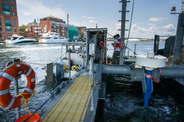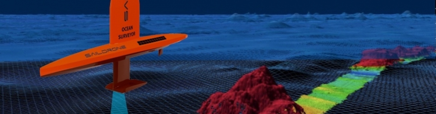
Add “sailboat” to the list of ways researchers are collecting data to map the ocean floor. The Saildrone Surveyor, currently under development and scheduled to be deployed in spring 2020, will be a 72-foot wind-powered unmanned surface vehicle (USV) capable of going out to sea for six to 12 months.
The latest mapping tool is the result of a three-year grant awarded to UNH from the National Oceanic and Atmospheric Administration (NOAA) in partnership with Saildrone, Inc. of Alameda, California, a company that designs and manufactures wind and solar-powered autonomous surface vehicles, and the Monterey Bay Aquarium Research Institute.
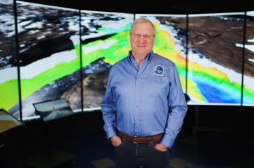
“This innovative partnership will produce a much more efficient and cost-effective way to collect needed data for mapping the ocean and monitoring the marine environment,” says Larry Mayer, director of UNH’s Center for Coastal and Ocean Mapping. “The data we collect will play a critical role in safety of navigation, tsunami and storm surge predictions, ecosystem and other environmental studies, and modeling climate change.”
Mayer is part of the international consortium known as Seabed 2030, a collaboration that aims to bring together all available bathymetric data to complete mapping the entire ocean floor by 2030. Mayer co-heads Seabed 2030’s Arctic and North Pacific Regional Data Center.
“The data we collect will play a critical role in safety of navigation, tsunami and storm surge predictions, ecosystem and other environmental studies, and modeling climate change.”
Working with UNH and Kongsberg, which specializes in advanced maritine techonologies that aid in the exploration of uncharted territories and the deepest seas, Saildrone will install three state-of-the-art sonar systems on the USV, enabling detailed mapping data of the seafloor and water column to be transmitted back to shore, some in real time. UNH will analyze and evaluate the data quality and will lead the development of autonomous data quality monitoring tools to identify targets of interest.
The Saildrone Surveyor will be equipped with a complete suite of environmental sensors to support studies looking at harmful algal blooms, microbial ecology, water quality, and environmental DNA (eDNA) indicative of invasive species and larger animals. The new USV will be piloted remotely rather than operated fully autonomously enabling responsive mission adaption whenever sensors indicate an area of interest.
“We are very pleased to be working with the University of New Hampshire and the Monterey Bay Aquarium Research Institute to further ocean characterization research using eDNA and achieve global bathymetry goals,” says Richard Jenkins, founder and CEO of Saildrone. “Over the past five years, Saildrone USV's have performed extensive missions in the Arctic, Antarctic, and Pacific and Atlantic oceans, proving it to be a capable and effective vehicle for collecting data in the most extreme environments.
“The larger Saildrone Surveyor is an exciting evolution that leverages all our expertise and experience to create an extremely capable platform to further explore our oceans and share that data with projects such as Seabed 2030.”
Funding was provided by NOAA's Office of Ocean Exploration and Research (OER) and is part of the National Oceanographic Partnership Program (NOPP) which facilitates partnerships between federal agencies, academia, and industry to advance ocean science research and education. Since 1997, NOPP has funded over 200 projects that address our nation’s economic development, national security, quality of life and science education.
-
Written By:
Robbin Ray ’82 | UNH Marketing | robbin.ray@unh.edu | 603-862-4864