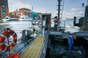
Photo by Tim Briggs.
Just after a particularly raucous bout of weather in April 2019, Rick Cliche and his wife, Leslie, pulled up to Hampton’s North Beach and found, to their utter surprise, ancient peat moss and weathered tree stumps where the sand used to be — the beach had effectively been scoured clean from the recent storms, exposing the remnants of an era thousands of years prior when the sea was much farther out than it is now.
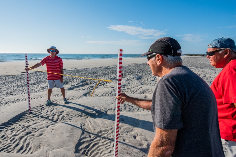
For years, the duo, along with some other volunteers-turned-friends, had been taking monthly measurements of the sand height at the beach to track long-term trends of erosion and accretion; coastal storms are notorious for altering the beach landscape, but they had never seen this radical a change before. Still slightly in awe of the scene before them, Rick and Leslie pulled measuring sticks out from their car and walked down to the water, where they began recording the height of what remained of the beach in front of the seawall.

Now with more than six years of data at that beach and five other beaches along New Hampshire’s coast, a bigger picture has started to emerge: the beaches south of Boar’s Head (including Hampton and Seabrook Beaches) are generally more resilient — this is, able to withstand storms much better than those to the north. The results, published in the journal Continental Shelf Research, are fueling discussions with New Hampshire’s coastal municipalities and New Hampshire State Parks about the future vision of the beaches, which are already facing pressures from sea-level rise and coastal storms that are becoming more intense and frequent.
Alyson Eberhardt, a coastal ecosystem extension specialist with N.H. Sea Grant and UNH Cooperative Extension, is the first author on the paper. She leads the Coastal Research Volunteers’ Beach Profiling Program, which relies on the help of 35 dedicated citizen scientists, like the Cliches, who go out at the lowest tide each month and after major storms to record the changing height, or profile, of the sand on beaches. Eberhardt examined their data results with the help of the paper’s co-authors: Wells Costello, a citizen science outreach coordinator with N.H. Sea Grant; Rachel Morrison, a research assistant with the UNH Center for Coastal and Ocean Mapping (CCOM); Larry Ward, a research associate professor for CCOM; and Chris Williams from the New Hampshire Coastal Program.
“It’s surprising to me how differently each of the beaches respond to storms,” Eberhardt says. “Now that we have a critical mass of long-term data, we’re starting to have conversations with coastal town leaders about what these results mean, what they want their shoreline to look like in the future and which beaches might benefit from management approaches such as sand nourishment (in which additional sand is brought to the site).”
Sand naturally moves back and forth between the shoreline and out to sea; winter storms typically pull sand farther out to sea and then re-deposit the sand at the coastline in the spring. However, myriad factors, both natural and manmade, are influencing where — and if — the sand comes back. And for a state with a 19-mile coastline, those changes can have an outsized impact on tourism, businesses and homes nearby.
“A beach with a higher elevation is generally more robust and better able to withstand storm energy, which means it’s best poised to protect the people and places behind it,” Eberhardt notes.
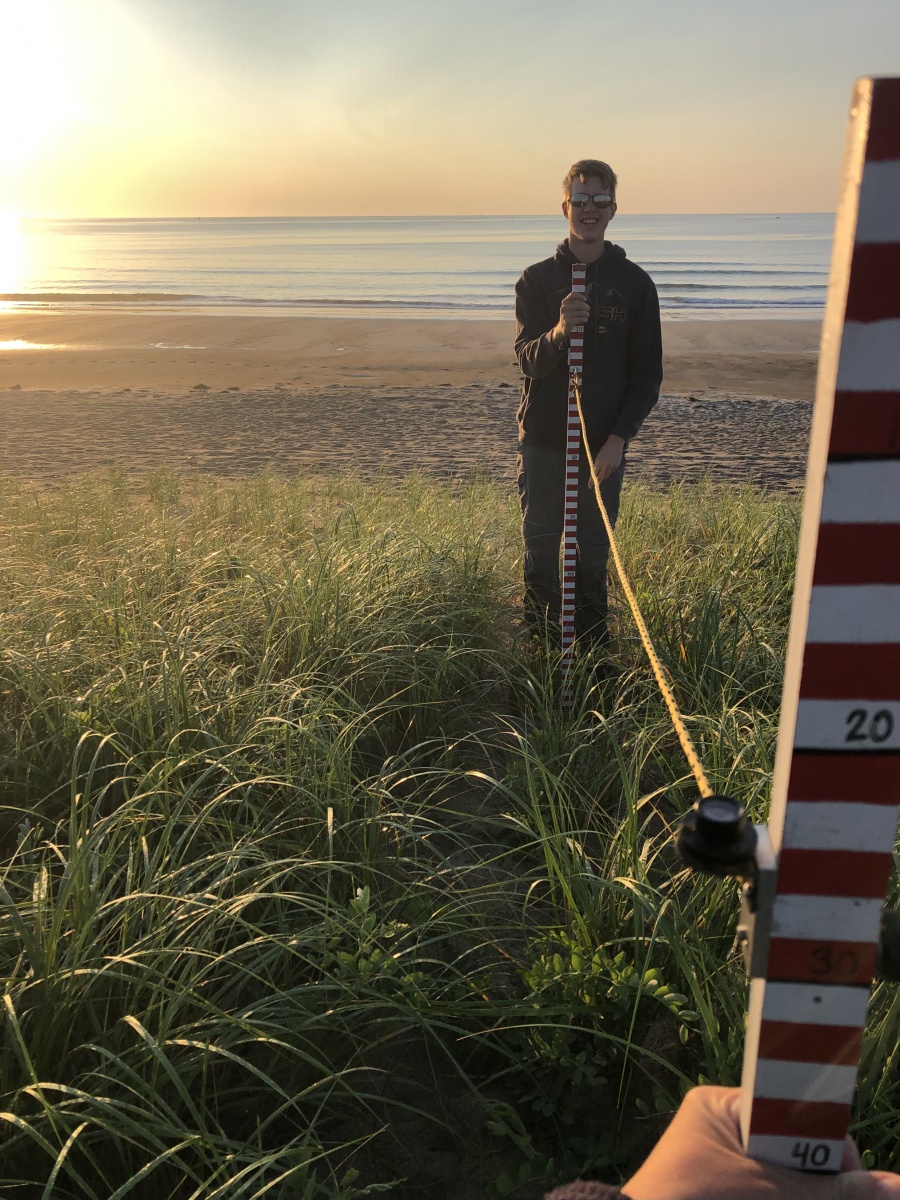
Bryce Stetson '25 helped to measure the height of Seabrook Beach during his high school years.
The beach profile data indicate North Beach is a full two meters lower than Hampton and Seabrook Beaches, and that difference is likely caused by a few factors: Both Seabrook and Hampton Beach State Park have dunes that naturally trap sand to help build the height of the beach, and they also benefit from the addition of sand every few years that’s dredged up from Hampton-Seabrook Harbor. North Beach and others to the north of Boar’s Head extend farther out to sea, and that, coupled with numerous seawalls and man-made berms, limits the amount of sand that gets redeposited, thus leading to lower beach elevations, more erosion, washover and flooding.
Eberhardt is quick to point out that the volunteers for the Beach Profiling Program who collected the data are equal partners in this research alongside the scientists. “We consider them experts — they’re the ones out there each month, navigating around beach towels or through gale-force winds to measure the sand height, and we really value their observations and interpretations on what’s going on with each site.”
"An important aspect of this study that has made it successful is the strong partnership between UNH, the N.H. Coastal Program, the N.H. Geological Survey and community volunteers,” Larry Ward from CCOM notes. “Partnering with citizen science programs increases the capacity to collect data at lower costs while not compromising quality. A further benefit of this type of collaboration is the creation of relationships between scientists, the local community, and management. All of these factors help to build coastal resiliency.”
Bryce Stetson ’25, who is majoring in marine biology, was one of those dedicated volunteers during high school. In between his homeschool studies, he traveled from his home in Milford, New Hampshire, to the Seacoast to assist with the height measurements of Seabrook Beach. With a natural affinity for marine science, Stetson says he was drawn to the Beach Profiling Program because of the monthly commitment and teamwork approach in proximity to the water. “It was a great way to get involved in science, to see how things are changing and meet people in that line of work,” he notes. “I found it really rewarding.”
This project was funded in part by NOAA's Office for Coastal Management under the Coastal Zone Management Act in conjunction with the New Hampshire Department of Environmental Services Coastal Program.
The UNH Institute for the Study of Earth, Oceans, and Space (EOS) is UNH's largest research enterprise, comprising six centers with a focus on interdisciplinary, high-impact research on Earth and climate systems, space science, the marine environment, seafloor mapping and environmental acoustics. With approximately 100 principal investigators managing more than 400 individual grant awards, and with annual expenditures exceeding $45 million, EOS fosters an intellectual and scientific environment that advances visionary scholarship and leadership in world-class and graduate education.
-
Written By:
Rebecca Irelan | Institute for the Study of Earth, Oceans, and Space | rebecca.irelan@unh.edu | 603-862-0990