A University of New Hampshire researcher contracted to test sonar systems on a research ship helped discover the wreck of the ship that took Robert Falcon Scott to the Antarctic.
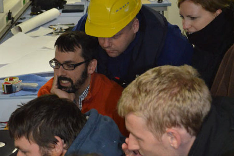
Jonathan Beaudoin (in glasses and orange sweater), research assistant professor in the University of New Hampshire’s Center for Coastal and Ocean Mapping/Joint Hydrographic Center, views the underwater footage of the S.S. Terra Nova with others onboard the Schmidt Ocean Institute’s R/V Falkor. Photo courtesy Schmidt Ocean Institute.
Jonathan Beaudoin, research assistant professor in UNH’s Center for Coastal and Ocean Mapping/Joint Hydrographic Center (CCOM/JHC), was onboard Schmidt Ocean Institute’s (SOI) flagship R/V Falkor off the coast of Greenland last month when the sonar systems he was evaluating and calibrating turned up a mast of the S.S. Terra Nova. The Terra Nova sank off the coast of Greenland in 1943.
“It was one of the best moments of my life,” says Beaudoin of the July 11, 2012, discovery.
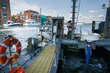
The discovery was not altogether serendipitous. The Falkor, newly equipped as a research vessel, had plotted a course for southern Greenland to test its multibeam mapping echosounders, used for mapping the seafloor. Leighton Rolley, an SOI marine technician familiar with the sinking of the Terra Nova, suggested a search for Scott’s ship while in the vicinity.
“We needed to test the sonars, and what better test than to find a small object on the seabed?” says Beaudoin. “It was a happy collision of circumstances.”
Built as a whaler in 1884, the Terra Nova took Scott and his crew to Antarctica in 1911 on Scott’s bid to be the first person to reach the South Pole. Not only was he beaten there by the Norwegian party led by Roald Amundsen, Scott and his entire team perished on the return trek across Antarctica. The Terra Nova survived, however, and until its sinking in 1943 it was used in various polar capacities, including seal fishing and trading.
|
Computer visualization of the S.S. Terra Nova wreck reproduced from the acoustic data acquired by the R/V Falkor’s multibeam echo sounder. Courtesy Schmidt Ocean Institute. |

|
S.S. Terra Nova funnel as seen in the underwater video frame filmed from R/V Falkor using SHRIMP (Simple High Resolution IMaging Package). Courtesy Schmidt Ocean Institute. >>VIEW VIDEO |

Beaudoin, who has plied cold waters before, knew that the ocean temperature would preserve the wooden hull of the Terra Nova. The team was concerned, however, that damage by icebergs – the fate that befell the ship in 1943 – could have broken the wreck into pieces, which would have made detection in sonar imagery much more difficult.
The wreck was not significantly damaged, however, which added to the excitement. Beaudoin was at the computer when sonar images of it first appeared in the ship’s lab. The observed target was later selected as the most likely candidate of all the potential targets imaged by the sonar; video imagery was acquired using an underwater camera system to confirm that it was indeed a wreck.
“When it scrolled past on the video screen, the whole room just erupted in a massive cheer,” Beaudoin says. “It was a pretty cool moment.” The discovery highlighted the work of the entire team on the Falkor, which included French organization Ifremer and Rolley and colleagues from SOI. Researchers from the Woods Hole Oceanographic Institute also were onboard collecting video plankton observations during the transit across the North Atlantic.
While measurements from the echosounder confirmed the wreck to be identical to those of the Terra Nova, Beaudoin notes that without a “smoking gun” of proof, something like silverware or dishware engraved with ship insignia, he and others approach the discovery with scientific caution. “It’s highly likely that it’s the Terra Nova. It’s a wreck that is consistent with the Terra Nova,” he says.
Now back in Durham, Beaudoin has returned to the original purpose of the voyage; he is finishing his analysis of the Falkor’s echosounders. “Everything was fine. The cruise, from our point of view, was a great success,” he says.
>>Read more about the discovery of the S.S. Terra Nova.
The Center for Coastal and Ocean Mapping/Joint Hydrographic Center (CCOM/JHC) was founded in 1999 with two main objectives: to develop tools to advance ocean mapping and hydrography, and to train the next generation of hydrographers and ocean mappers. The JHC is a formal cooperative partnership between the University of New Hampshire and the National Oceanic and Atmospheric Administration (NOAA) whose aim is to create a national center for expertise in ocean mapping and hydrographic sciences.
Established in March 2009, the Schmidt Ocean Institute seeks to advance ocean exploration, discovery, and knowledge, and catalyze sharing of information about the oceans. The Institute is devoted to the inspirational vision of our Founders that the advancement of technology and open sharing of information will remain crucial to expanding the understanding of the world's oceans. Since the Earth's oceans are a critically endangered and least understood part of the environment, the Institute dedicates its efforts to their comprehensive understanding across intentionally broad scope of research objectives.
The University of New Hampshire, founded in 1866, is a world-class public research university with the feel of a New England liberal arts college. A land, sea, and space-grant university, UNH is the state's flagship public institution, enrolling 12,200 undergraduate and 2,300 graduate students.
Originally published by:
UNH Today