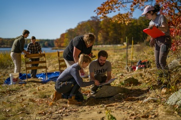


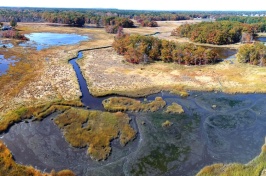


After four hundred years, it’s still not settled science: How, exactly, did the early English colonists travel over the landscape and waterways to put down roots along the shores of New Hampshire’s Great Bay Estuary? The 17th century maps and written accounts are riddled with gaps and potential biases. But now, UNH scientists are using an innovative tactic that reveals the decision-making behind colonists’ movements across the region — while also re-examining our own inherited narrative about colonialism.
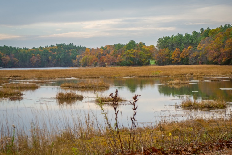
Their research, published in the Journal of Archaeological Science, indicates that wetlands and the head of tides played a large role in how the colonists began working their way up into the Great Bay Estuary to establish their homesteads in the region. By using a computer model typically applied to ecological research, scientists tapped into this powerful and holistic tool and used it in a way that had never been done in archaeology — one that provides a more accurate historic simulation of the area’s colonization and may help anthropologists locate additional archaeological sites in the future.

“This computer model offers a new lens through which we can view the colonists’ movements into the region — a lens that is less dependent on the sparse documentation and likely biased records of that time period,” says Dylan Kelly ‘24G, a Ph.D. candidate majoring in natural resources and environmental studies with a background in archaeology who is first author on the study. “More broadly speaking, applying these model simulations to regions where you have limited archaeological evidence provides a means for scientists to study how landscape-scale decisions about human movement and land-use played out.”
Previously, archaeologists used models that pieced together historic human movements across a landscape by going point to point, providing a limited set of options for human travel — almost as if they were wearing blinders to the full range of possibilities that lay before them. The omnidirectional circuitscape model that Kelly and his co-authors used opens up to the entire landscape, just as the colonists would have viewed the totality of their surroundings and weighed the potential benefits and challenges of all possibilities for their next move.
They examined variables like proximity to wetlands (which offered vital resources, like salt marsh hay), topography and landscape cover (colonialists' intensive lifestyles involved farming, lumbering, pasturing, and other activities influenced by the land), and where the tides ended upriver (colonialists’ boats were not as small and nimble as canoes, so their water-based travel was limited at first).
"This computer model offers a new lens through which we can view the colonists' movements into the region — a lens that is less dependent on the sparse documentation and likely biased records of that time period."
Kelly then ran simulations of colonists’ dispersal throughout the region and compared the model results — the locations where humans were predicted to have ended up on the landscape based on those movement choices — to where archaeologists have found artifacts and other evidence of colonist homesteads and activities in order to validate the success of the model. The model was a surprisingly good predictor of where the colonists put down roots, Kelly notes, and he hopes it can be used to locate other undiscovered archaeological sites in the region.
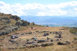
The research fits into the larger historical picture being revealed by the Great Bay Archaeological Survey, a project led by Meghan Howey, UNH professor of anthropology in the College of Liberal Arts and the Earth Systems Research Center. Howey is a co-author on this published research, and she notes, “This computer model is such a great advancement for archaeology. We can really get at the nuances of the colonists’ decision-making about moving over the land and water — their mindset, choices, behaviors and limitations.”
Howey also explains the importance of treating a historical period as if it’s completely unknown. “It’s easy to fall back on our inherited knowledge; that’s the stuff written down by the people who controlled society at the time, but let’s not assume we know everything just because we have strong associations with those stories,” she says. “It’s important to treat history scientifically — question it, model it, validate it, advance how we understand it. That gets us closer to the truth of what really happened.”
Moving forward, Howey is working with tribal partners on a model driven by Indigenous knowledge, one that explores their people’s embeddedness in the landscape, in order to see how that knowledge compares and contrasts to the decisions made by the colonists of that era.
Funding for this research was provided by a grant from the Carnegie Corporation of New York, and by UNH’s James H. and Claire Short Hayes Humanities Chair – Center for the Humanities.
The UNH Institute for the Study of Earth, Oceans, and Space (EOS) is UNH's largest research enterprise, comprising six centers with a focus on interdisciplinary, high-impact research on Earth and climate systems, space science, the marine environment, seafloor mapping and environmental acoustics. With approximately 100 principal investigators managing more than 400 individual grant awards, and with annual expenditures exceeding $77 million, EOS fosters an intellectual and scientific environment that advances visionary scholarship and leadership in world-class and graduate education.
-
Written By:
Rebecca Irelan | Institute for the Study of Earth, Oceans, and Space | rebecca.irelan@unh.edu | 603-862-0990