


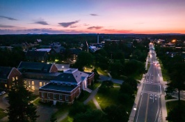


Large, extreme events such as hurricanes and superstorms are becoming more frequent under a changing climate. Researchers with the New Hampshire Agricultural Experiment Station at the University of New Hampshire are looking to new findings from a major hurricane in Puerto Rico to understand how large storms may affect New England watersheds, streams, and river networks.
UNH Researcher Publishes Paper on Role of River Corridors in Critical Zone (CZ) Science
Multidisciplinary approach to studying streams and rivers can help tell a rich story about the Earth’s critical zones
Friday, July 28, 2023
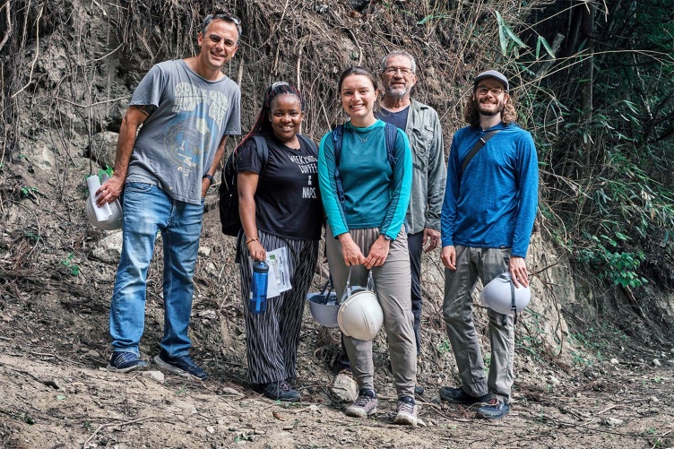
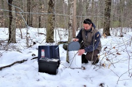
A group COLSA students and faculty recently attended a summer course on the Critical Zone and land-use change and impacts at the University of Tsukuba in Japan. During the program, the team studied CZ science alongside an international team and visited key CZ research sites across Japan, including this one in Fukushima. From left, research assistant professor Adam Wymore, Natural Resources and Earth Systems Science (NRESS) Ph.D. student Clarisse Ishimwe, Natural Resources and the Environment master's student Alicia Dixon, professor Bill McDowell, and NRESS Ph.D. student Eric Parker.
Key Finding:
The study of river corridors as components of the Earth's critical zone plays a crucial role in understanding their unique dynamics, integrating various systems within the critical zone and addressing societal challenges. Adopting an integrative and multidisciplinary approach that encompasses modeling, observational science and data science is key to enhancing how well predictions about ecosystems can be made and promoting effective management of river corridors.

The Critical Zone consists of Earth's outer skin.
Attribution: Earth's critical zone. Illustration by Critical Zone Observatories (CZO) based on a figure in Chorover et al. 2007.
The Critical Zone (CZ): Consists of the Earth’s outer skin, from the tops of the vegetation down to the bedrock and free-flowing groundwater. As defined by the National Science Foundation’s Critical Zone Observatories program, the CZ is “a living, breathing, constantly evolving boundary layer where rock, soil, water, air, and living organisms interact. These complex interactions regulate the natural habitat and determine the availability of life-sustaining resources, including our food production and water quality.” National Science Foundation definition
CZ Observatories: Expand for definition
Group of 10 sites located across the contiguous United States and in Puerto Rico selected for their unique characteristics as places to study the CZ.

A map showing Critical Zone Observatories across the United States.
CZ Collaborative Network: Expand for definition
Succeeding the CZ Observatories program, the Network clusters unique CZ sites based on a “wide range of geological, climatic, and land use settings that provide an opportunity to better understand the critical zone.”
River (or stream) corridor: Expand for definition
Spaces in which streams and rivers move and flow, as well as the land adjacent to the water on either side. River corridors integrate actively flowing channels, floodplains, riparian areas and underlying near-stream aquifers that mix with surface water.
Weathering front: Expand for definition
A point below the Earth’s surface (and the bottom or base of the Critical Zone) marking the lowest extent of freely circulating groundwater, where unweathered bedrock meets weathered (or eroded) rock and soil.
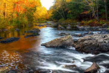
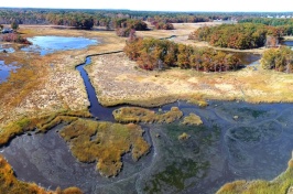
Every river has a story to tell, and the stories of New Hampshire’s approximately 19,000 miles of streams and rivers can fill a library. Writing down and learning from those stories, however, requires a scientific framework that can interpret the myriad processes that occur in and around the dynamic river environments. New research at the New Hampshire Agricultural Experiment Station shows how a multidisciplinary approach to studying streams and rivers can help tell a rich story about the Earth’s critical zones—where “rock meets life.”
What is Earth’s Critical Zone?
The critical zone encompasses nearly all the processes required to sustain terrestrial life occur—from the bedrock and the depths of free-flowing groundwater to the tops of vegetation where plants pull carbon dioxide from the atmosphere. Studying critical zones requires a multidisciplinary approach that can connect everything from photosynthesis to weathering to plate tectonics, across different timespans and ecosystems. In a paper published in Frontiers in Water, Station scientist Adam Wymore, a research assistant professor in the natural resources and the environment department at UNH, and his co-authors describe how an integrated assessment of stream and river corridors—the land and associated ecosystems adjacent to flowing water—can further the understanding of critical zones.
“The one place on the landscape that can provide a really integrated view of the entire critical zone is the stream at the bottom of the valley,” described Wymore. “Because of gravity, it’s getting all these inputs—groundwater, soil water, rainwater—as things flow downhill, and it provides a look of the critical zone changing over space and time and how the critical zone responds to natural and human disturbances.”
Wymore and his co-authors also point out the disproportionate impact that streams and rivers have on the landscape. For taking up such a small portion of the landscape, they move a large amount of material around, form valleys and spread organic matter and nutrients over great distances.
“The effect of these corridors on the landscape is massive, especially in comparison to how much of the Earth’s surface is covered by freshwater including streams and rivers,” Wymore added. “Because of that, it’s important to have an integrated approach to understanding the magnitude of their impacts.”
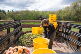
Humans are inextricably connected to river corridors and have been for most of human history, Wymore added. Granite State’s rivers and surrounding ecosystems are also critical to sustaining the state’s agricultural production, forested lands and wildlife, provide drinking water to many communities, and beatify and drive economic activity. And because communities and associated infrastructure built within river corridors take advantage of all the services that the waterways provide, human activity must also be calculated into critical zone and similar models.
“We benefit from the river corridor but also have a major impact on these environments,” said Wymore. “Thus, we have to integrate human activity into our models of river corridor function and resilience to future global change.”

A photo showing a cross section of a cliff face and identifying the Critical Zone element along with a chart showing the overlap in areas that CZ science encompasses. Attribution: Ashlee Dere, University of Nebraska at Omaha
This material is based on work supported by the NH Agricultural Experiment Station through joint funding from the USDA National Institute of Food and Agriculture (under Hatch award number 1022291) and the state of New Hampshire. Additional funding came from the National Science Foundation and EPSCoR project Canary in the Watershed (NSF EPS-1929148) and the NSF-funded Belmont Forum ABRESO project (NSF-2129383).
This work is co-authored by Adam Wymore, Adam Ward, Ellen Wohl and Judson Harvey.
You can read the published article, Viewing river corridors through the lens of critical zone science, in the latest issue of Frontiers in Water.
-
Written By:
Nicholas Gosling '06 | COLSA/NH Agricultural Experiment Station | nicholas.gosling@unh.edu