


The Goals of the LRHO
The Lamprey River Hydrological Observatory (LRHO) was established in 1999 to “investigate the effects of suburbanization and changing seasonality on watershed hydrology, biogeochemistry, and nutrient export” for the Lamprey River watershed. The LRHO was established by NHAES scientist Bill McDowell, a professor in the natural resources and the environment (NREN) department, and J. Matthew Davis, associate professor of the earth sciences department. Additional LRHO members include NHAES scientists Adam Wymore, a research assistant professor in NREN, Wil Wollheim, an associate professor in NREN; Jennifer Jacobs, a professor of civil and environmental engineering; and Michelle Shattuck, associate director of the NH Water Resources Research Center at UNH. Over the years, numerous graduate students and post-doctoral fellows have also completed research through the LRHO.
The goal of the LRHO is to collect data to help answer several questions, including:
- How do suburbanization and similar land-cover changes impact surface water chemistry?
- How do watershed attributes influence surface and groundwater chemistry?
- What are the long-term impacts of suburbanization on water nitrogen levels?
- What is the effect of changing seasonality and climate on watershed biogeochemistry?
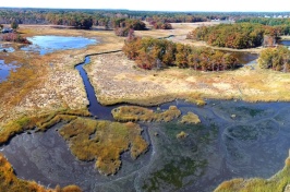
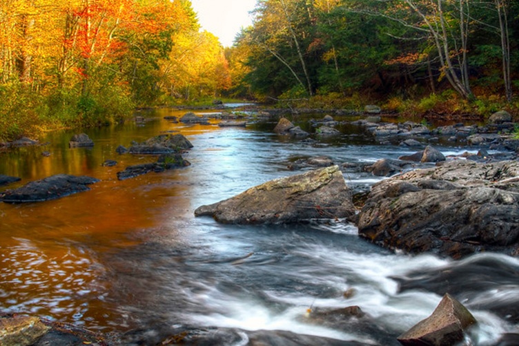
From its headwaters near Northwood Meadows State Park in Northwood, NH, the Lamprey River meanders for more than 50 miles until it empties out into New Hampshire’s largest and most culturally significant estuarine environment, the Great Bay. Like many other rivers in the state, the Lamprey River–and the close to a dozen tributaries that empty into the Lamprey–winds through forested regions and agricultural lands, but also through busy downtowns, like Newmarket and Epping, and a variety of mixed-use and suburban landscapes. Rivers can tell a rich story about how each of these ecosystems impacts water quality and how this quality has changed over time. Recent research from the NH Agricultural Experiment Station (NHAES) describes ongoing efforts to combine over 20 years of existing data with information gathered from more advanced sensors to show the impacts of climate change, suburbanization and mixed land-use environments on water chemistry and nutrient discharge.
Long-term research of the Lamprey River can provide particularly impactful insights. Its partial protection under the National Wild and Scenic Rivers Act and passage through areas growing in population density— where most households use on-site waste disposal, like septic systems, that can pass nitrogen into water runoff—offer conditions for studying the impact of suburbanization on a water body. The Lamprey’s location, in a temperate region where winters are experiencing less snow and more rain than they did two decades ago and the transitional seasons between winter (spring and fall) are lengthening, make it an ideal watershed for studying climate change.
The Lamprey River Hydrological Observatory (LRHO) has been collecting data on the chemistry and hydrology of the 212-square-mile Lamprey River watershed, providing a baseline of data on river/stream discharge, levels of nitrogen and greenhouse gases (including methane and nitrous oxide), and dissolved organic matter to compare with future climate change-based measurements and provide a historic look at how a developing landscape and warming climate have affected the river to date. As a result, LRHO scientists have been able to use the 20-year data set to identify different trends, such as quantifying how a loss of forest cover (due largely to suburban development) results in increased levels of nitrate in the Lamprey tributaries that span a range of forest cover.
Members of the LRHO, including scientists with the NHAES, wrote about their data from the Lamprey River in an article published in Hydrological Processes. The paper is also part of a larger effort among hydrological observatories around the world to share their findings and datasets, making the information publicly available and providing a library of long-term data on changing watersheds and aquatic ecosystems while further opening the doors to collaboration.
Land use in the Lamprey River watershed

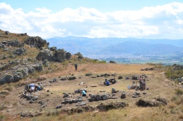
Stream sampling locations in the LRHO

“Being part of an international effort is something that’s really important – it helps get us to a point of shared data and collaboration and transparency with our science and data sets,” described NHAES scientist Adam Wymore, lead author on the paper and a research assistant professor with the natural resources and the environment department.
The fact that these data focus on the Lamprey River watershed is critical too, added Wymore, as the Lamprey represents a watershed typical of rural and suburban New England.
“It’s still a mostly forested landscape, but there’s a slow change that’s occurring in respect to development and impervious cover as more people move to the New Hampshire seacoast and more property is developed.”
“It’s still a mostly forested landscape, but there’s a slow change that’s occurring in respect to development and impervious cover as more people move to the New Hampshire seacoast and more property is developed,” said Wymore. “Not only is that a common phenomenon throughout New England and in other parts of the country as well, but because the data set was started 20 years ago, we’ve been able to capture that process and show it in our observations.”
The length of the study has also allowed Wymore, McDowell and their colleagues to gather data that characterize river dynamics after extreme weather events, including multiple record-breaking winter and summer droughts, back-to-back 100-year-scale floods (in 2006 and 2007) and shifting seasonal changes, like shorter winters and longer springs. Additionally, LRHO researchers have identified changes in the chemistry of surface water within the watershed over time, such as that nitrate levels within the river and tributaries are slowly rising while dissolved organic nitrogen is steadily decreasing. However, how this will impact downstream critical waterbodies, like the Great Bay estuary, remains to be seen.

“Because Great Bay estuary is impaired by too much nitrogen, being able to quantify the impacts of potential future development in the Lamprey watershed is essential for developing future-oriented management strategies for Great Bay,” said McDowell. “At the same time that we have documented the impacts of land use patterns on nitrate levels, we have also shown that rain and snow have actually gotten cleaner over the last 20 years or so.”
“Because Great Bay estuary is impaired by too much nitrogen, being able to quantify the impacts of potential future development in the Lamprey watershed is essential for developing future-oriented management strategies for Great Bay.”
“This demonstrates that regional improvements in air quality translate into local improvements in precipitation chemistry, and it’s something we’ll continue monitoring in the Lamprey River watershed during the next decade of sampling.”
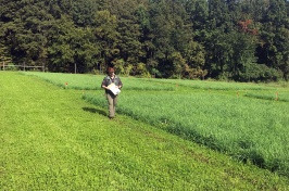
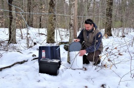
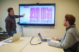
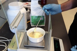
The data also show a change in observation and collection methods as new scientific instruments have allowed LRHO members to gather samples more efficiently. Researchers have performed traditional water sampling, collecting water samples from more than 20 sites on a weekly or monthly basis, since 1999. However, in 2013, a series of high-frequency multi-probe sensors were installed throughout the watershed to provide more regular and accurate data on water nutrient levels. Sending data transmissions every 15 minutes to researchers, these sensors collect data throughout New Hampshire winters, whereas similar water quality studies in similar climates often remove their sensors during the winter months. Additionally, because of their multi-probe design, these sensors can collect an array of data – on nitrate and dissolved organic matter concentration, pH levels and temperature, dissolved oxygen, turbidity, and more – offering a more complete picture of the conditions of the rivers and streams at the moment in time when the readings are taken.
This material is based on work supported by the NH Agricultural Experiment Station through joint funding from the USDA National Institute of Food and Agriculture (under Hatch award number 1022291 and 1019522) and the state of New Hampshire.
You can read the published article, The Lamprey River Hydrological Observatory: Suburbanization and changing seasonality, in the in Vol. 35, Issue 4, of Hydrological Processes.
-
Written By:
Nicholas Gosling '06 | COLSA/NH Agricultural Experiment Station | nicholas.gosling@unh.edu